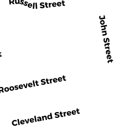
0015 RUSSELL STREET
Owner Information
PLACE WADE A & HEIDI L
15 RUSSELL STREET
ACUSHNET, MA 02743


Property Details
0015 RUSSELL STREET is classified as a Single Family Residential (Old style).
The primary structure on this property was built in 1940. There are 996ft2 of built area within this property. There is 996ft2 of residential/living space within this property. This property is listed as having 6 rooms.
0015 RUSSELL STREET is valued at $188,400. The land is valued at $79,200 and the structures are valued at $108,800. There is an additional valuation of $400 on this property.
The most recent deed for 0015 RUSSELL STREET is recorded at the local registrar in Book 9038, Page 199. 0015 RUSSELL STREET was last sold on Wednesday, May 14, 2008 for $185,000.
Assessment data from fiscal year 2021.
Flood Data
According to the FEMA National Flood Hazard Layer, this property does not appear to be in a flood zone. It may also be in an area not yet reviewed. Nonetheless, confirm this information prior to taking any action.
To view the flood hazards around this property, create a FEMA "Firmette" Map of the area around 0015 RUSSELL STREET.
Broadband Internet Providers
| Provider | Type | Bandwidth (mbps) | |
|---|---|---|---|
| VSAT Systems, LLC. | Satellite | 2 | 1 |
| Viasat Inc | Satellite | 35 | 3 |
| Verizon New England Inc. | DSL | 15 | 1 |
| TPx Communications | Copper Wire | 0 | 0 |
| Comcast | Cable | 1000 | 35 |
| T-Mobile | Fixed Wireless | 25 | 3 |
| GCI Communication Corp. | Satellite | 0 | 0 |
| HughesNet | Satellite | 25 | 3 |
Broadband service provider data from December 2020.
Adjacent Properties
- 0 GRANT STREET
Vacant, Selectmen or City Council (Municipal) owned by TOWN OF ACUSHNET SELECTMEN - 0021 RUSSELL STREET
Single Family Residential owned by ROBINSON JEANETTE - 0011 RUSSELL STREET
Two-Family Residential owned by LEVESQUE TIMOTHY - 0011 R RUSSELL STREET
Single Family Residential owned by LEVESQUE TIMOTHY